Historians of British North America have produced innumerable volumes on the violence of Native American territorial dispossession. However, scholars have paid far less attention to conflicts relating to Euro-American encroachments on ancestral Indian waterways and littorals. This study employs a Geographic Information System (GIS) to analyze the spatial distribution of British military deaths during Pontiac’s War of 1763. It illustrates where British soldiers died and identifies the geographic center of the Indian attacks. My findings indicate that the concentration of British military casualties near Forts Detroit, Niagara, and Pitt (Pittsburgh) speaks to the importance both sides gave to possessing the connective nodes of eastern North America’s inland waterways. Historians of Pontiac’s War have meticulously detailed the conflict’s multi-causal origins. Factors that pushed Native Americans to violence included disputes over land, diplomatic insults, the disruption of French trade practices, the curtailment of gift giving, and the Delaware Prophet Neolin’s pan-Indian spiritual movement. Indians participating in the attacks included Senecas, Delawares, Shawnees, Ottawas, Wyandots, Hurons, Potawatomi's, Ojibwe, and Miamis. Recent scholarship on Pontiac’s War illuminates how local factors, past experiences with British officials, and the disruption of the fur trade produced divergent Indian responses to the hostilities. Nonetheless, representatives from these nations coalesced into an effective military alliance whose accomplishments altered the trajectory of British North America.
Fig. 2. Note the narrow rivers and straits connecting North America’s largest freshwater bodies. During Pontiac’s War (1763) these were the places where Native Americans and British soldiers fought and died in the highest numbers.
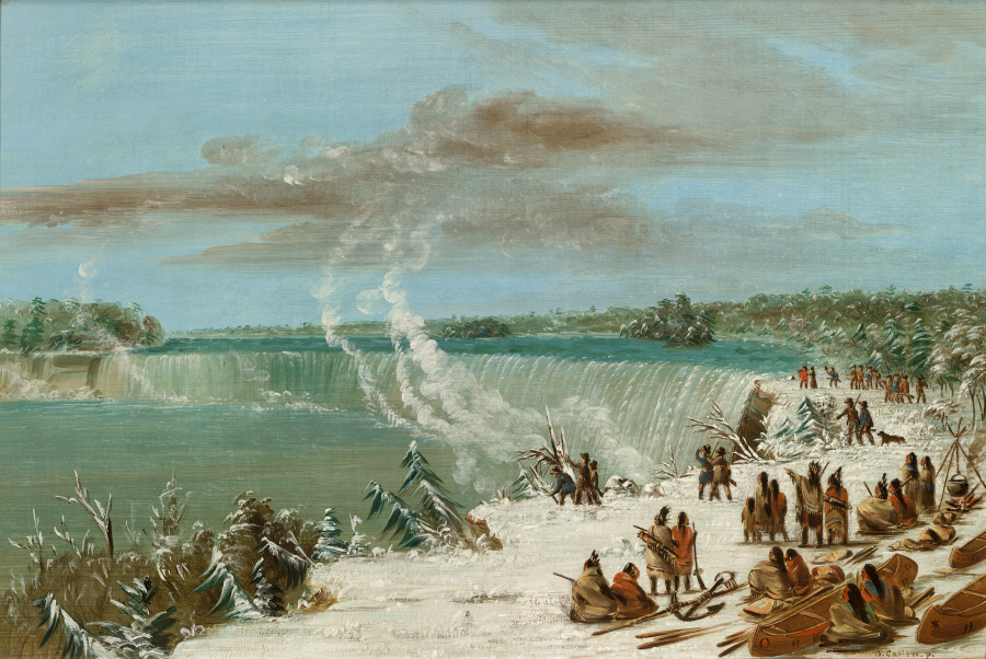
Possessing a shared understanding of the posts’ significance, Indian combatants gathered in the hundreds to dislodge the British from important frontier fortifications. Historians have explained the posts’ role in the fur trade and how garrisoning the forts legitimized British territorial claims in the North American interior. Scholars have paid less attention to the posts’ critical roles in controlling inland waterways. The combatants recognized that possessing places like Detroit—which presided over the intersection of Lakes Erie and Huron—was a shared objective in achieving their diverse aims. In the first months of the war, Indian forces expelled the British from nearly all of the frontier forts. Hundreds of Indian combatants besieged Forts Detroit and Pitt, while Seneca warriors inflicted heavy losses on British supply lines near Niagara. Indian and British forces adapted their tactics according to local conditions in their efforts to achieve their mutual objective of controlling key waterways.Geographic features near Forts Niagara, Detroit, and Pitt conveyed advantages to the British defenders and Indian attackers. British vessels could re supply Niagara and Detroit, but only at great risk. Niagara Falls forced British soldiers to disembark and walk a proverbial gauntlet around the falls on narrow cliff paths with no protective cover. Seneca warriors inflicted the war’s single greatest instance of British military deaths at the Niagara carrying place. Hostile Indians wreaked havoc on British relief expeditions as they moved from Lake Erie into the Detroit River’s narrow waters. The overland roads that linked Fort Pitt to the eastern colonies were famously hazardous to British armies. Ohio Valley Indians nearly wiped out the entirety of a sizeable British relief force en route to Fort Pitt, which sat at the confluence of the Allegheny, Monongahela, and Ohio rivers.
Fig. 3. Map depicting geographic degrees of violence in Pontiac’s War, 1763
A digital analysis of the distribution of soldier deaths using GIS spatial algorithms further illustrates the importance of inland waterways during the conflict. I discovered a correlation between geography and soldier death rates by extrapolating the casualty data contained within British military reports. Using inverse distance weighting (IDW) computations within a GIS, I determined the relative danger levels (based on weighted death rates) of areas within the contested region (see Figure 3). IDW is an interpolation method that estimates values for locations without data using values of nearby known data points. GIS analysis also revealed the geographic center of the conflict. I used GIS algorithms to determine the precise centroids (the arithmetic means and medians weighted and unweighted by death toll) of the Indian attacks on British soldiers. Even though the Indians killed soldiers on land, each computation revealed Lake Erie to be the geographic center of the conflict (see Figure 4).
Fig. 4. Map depicting the precise geographic center of Pontiac’s War, 1763
The Indians of the Great Lakes and Ohio River Valley relied upon canoe transport to sustain their way of life. The British presence at posts like Detroit, Niagara, Pitt, and Michilimackinac threatened their ability to move freely on the water and to control British access to their ancestral waterways and littorals. The Indian nations that comprised the pan-Indian alliance held diverse motives and aims, but they shared an understanding that it was in all of their interests to dispossess the British of their interior forts.